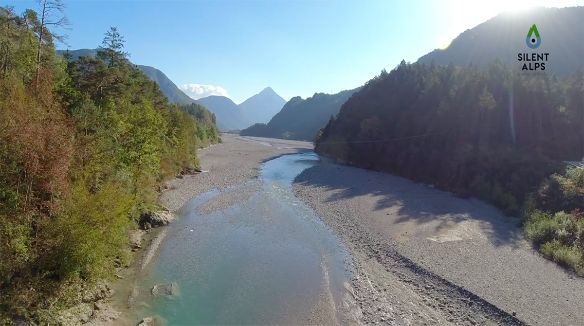
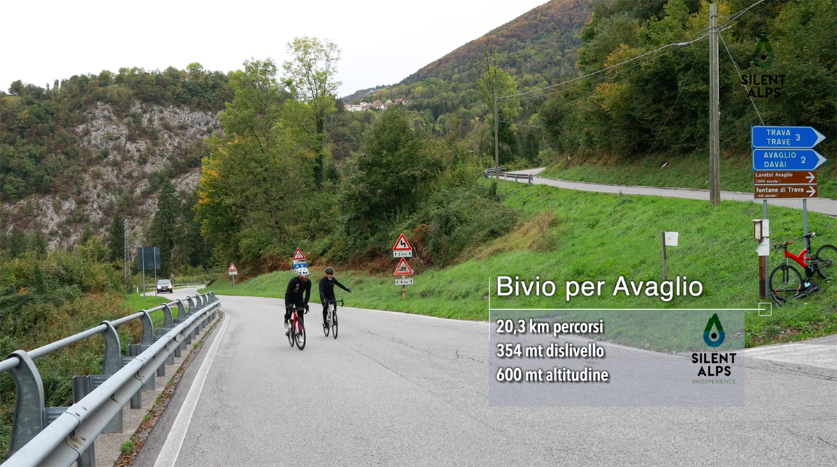
Our fifth route is the one we call Cycling in Carnia. It’s an intimate route that takes in the valleys of the But the Tagliamento, the Degano and the Valcalda, to arrive at the “least challenging” face of Mount Zoncolan (in inverted commas for a reason we’ll explain later). Departing from our kilometre zero – i.e. the convenient car park at Terme di Arta we immediately head south on the secondary road that passes through the villages of Zuglio and Terzo. After about 10 km we join a cycleway that takes us away from the main road and through the village of Invillino. Arriving at Villa Santina, at km 16.9, we start a 5-km climb with an average gradient of 7% for Avaglio.
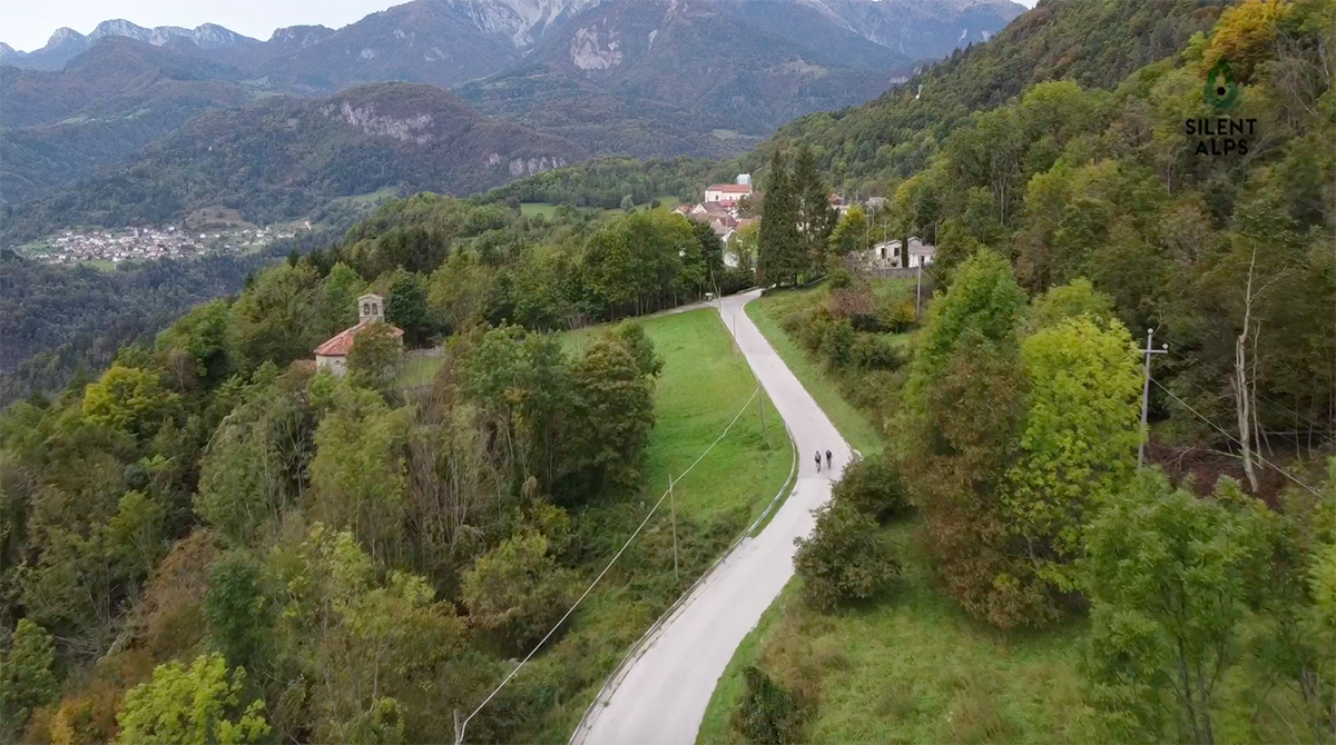
The first 3.5 km are fairly gentle and wide, but the gradient increases in the last 1.5 km before reaching Avaglio. Here (km 22.2) we can enjoy one of the finest views of this route, over the whole of the Tagliamento valley towards the Friulian Dolomites. Cycling on, we pass through the village of Trava, then begin a descent that demands close attention, due to the steep incline and consequent difficulty in controlling our bikes. After the descent, the track continues to follow the main road below, which we join at km 26.9.
Take great care here, as the junction can be tricky. Traffic coming from Tolmezzo always travels fast, and it’s best to stop and check there’s nothing coming before pulling out. After 1.6 km on the road, turn left onto the bridge over the Degano. Here we begin the climb to Muina: a 1 km stretch where “stretch” is the operative word. A climb whose final section reaches a gradient of 18%. But the effort is ultimately rewarded as we enjoy the Degano valley passing the villages of Agrons, Cella and Luincis.
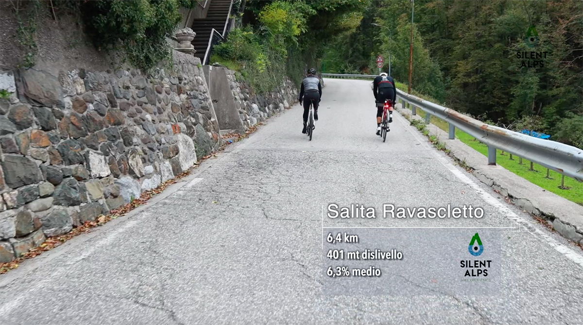
This is quintessential Carnia, and cameras will be red hot as they try to capture one of the most beautiful views on this route. Above us are the “three monsters of Carnia”: in order of difficulty, the Stentaria, the Zoncolan from Ovaro and the Crostis. After 36.4 km we reach Comeglians, and an obligatory stop before tackling the climb to Ravascletto. An ascent that has featured in the Giro d’Italia countless times, as this is a crossroads where the pink-clad athletes head for the Zoncolan climb.
It’s not too difficult, at 6.5 km and an average of 6.2%, but it’s perfect to stretch the legs and relax a little before facing the day’s toughest section: the Zoncolan from Sutrio. At the bottom of the downhill stretch at km 50.6, we turn right and begin one of the Giro d’Italia’s most important ascents. It was part of the 2021 route but, most importantly, was the scene of one of the last races of our beloved “Pirate” Marco Pantani in 2003.
Here, at the start of a climb that will prove to be merciless, the gradient is gentle, with an average of 7-8% and occasional peaks of 10%. The road is very wide, as it is used by vehicles to access the mountain huts at the base of the winter ski installations. The surface is smooth as a billiard table, and the only sound will be your wheels turning as you move.
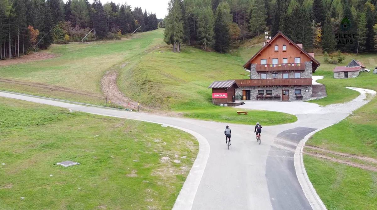
The views to right and left during the ascent change as you climb above the But valley and it appears increasingly distant. Until the 9th kilometre or so, our only advice to you is to enjoy the show. But we have no choice but to let you know what’s in store next. Here, when your computer tells you you’ve cycled 59.6 km with elevation gain of 1860 m, the climb unexpectedly gives way to a gentle flattish stretch of approximately 1 km, arriving at the buildings that serve the ski lifts.
It’s all lovely and relaxing until you reach the point where the ski slopes suddenly head for the summits: you’ll see the same thing on the road, which NO LONGER HAS ANY PITY FOR YOU!
For exactly 3 kilometres from km 60.8, it’s a stairway to heaven, with never-ending hellish ramps and peaks of 20%. The most terrifying – just like in the best horror films – comes at the end, and we promise this will be a truly “thrilling” experience!
No bends at all, and 800 metres of straight road with a concrete wall on your left, leading up to the flat area at the top and the end of your torture. On this stretch, the gradient is never less than 16%, and you’ll definitely regret putting too much effort into the easy initial 9.5 km! But don’t worry, it’s a mistake made by many who come with the idea that the only difficult part of Zoncolan is the Ovaro route, or who have never read a review on Silent Alps BikExperience. Big hugs and GOOD LUCK.
Distance: 82 Km
Elevation gain: + 2380 mt
Max altitude: 1750 mt
Min altitude: 319 mt
Max gradient: 21%
1
2
3
4
5
6
7
8
9
10
11
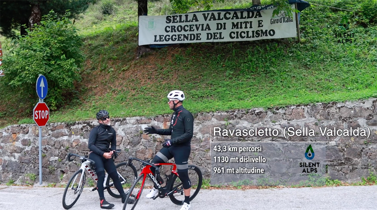
12
13
14
15
16
17
18
19
20
21
22
23
24
25
26
27
28
29
30
31
32
33
34
35
36
37
38

1
Km 0
Departure from Terme di Arta car park.
2
Km 8,3
Turn right towards Villa Santina.
3
Km 10,0
Join the cycleway.
4
Km 13,3
Detail of the cycleway.

5
Km 15,0
The village of Invillino.
6
Km 15,5
Bridge over the Tagliamento.
7
Km 17,0
Start of the climb to Lauco.
8
Km 20,2
Turn right for Avaglio.
9
Km 20,4
Località Avaglio.
10
Km 22,0
End of the climb.

11
Km 22,6
End of the climb.
12
Km 23,5
Crossing Trava.
13
Km 26,7
Leave the secondary road and take the main road.
14
Km 28,4
On the bridge to Muina.
15
Km 28,8
Start of the steep section to Muina.
16
Km 29,0
Muina.

17
Km 29,8
The steep section at Muina.

18
KM 31,5
Santa Maria church in Gorto.
19
Km 31,5
Santa Maria church in Gorto.

20
Km 32,0
View over the Degano valley.
21
KM 34,2
Luincis
22
Km 34,2
Luincis.
23
Km 35,1
Turn right onto the bridge.
24
Km 36,6
Comeglians village, with an ancient bar on the square.
25
Km 37,0
Turn right to begin the climb to Ravascletto.
26
Km 43,3
Sella Valcalda.
27
Km 44,0
Start of the descent to Sutrio.
28
Km 50,6
Start of the ascent of Zoncolan from Sutrio.
29
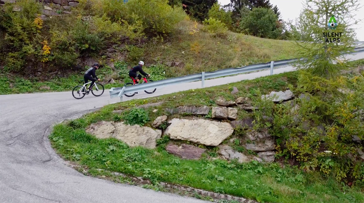
Km 53,3
Hairpin bends with stunning views

30
Km 54,0
View from the bends.
31
Km 60,0
Turn left.
32
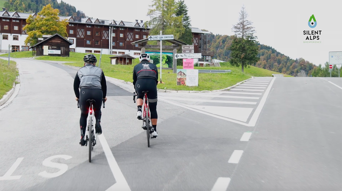
Km 60,3
Rifugio Al Pignau.
33
Km 61,0
Start of the ascent of Zoncolan from Sutrio.
34
Km 62,2
Steep hairpin bends.
35
Km 63,2
Straight section with gradient of 21%.
36
Km 63,9
Sella Monte Zoncolan.

37
Km 78,0
Restaurant Monte Zoncolan.
38
Km 78,0
Ristoro Mr. Zoncolan.